Summary:
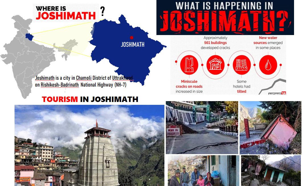
Joshimath is situated in Chamoli district of Uttarakhand, popularly known for its ancient pilgrimage sites but recently is in the news due to the land subsidence linked to its unplanned construction, drastic road widening and hydropower projects that have ignored multiple warnings. Joshimath has always been at risk due to the fact that it was constructed over landslide debris. In frigid month of January, residents were forced to flee their homes due to development of cracks in walls and foundations owing to severe structural damages. Honourable Prime Minister has declared the area as “Landslide-subsidence zone” and also consulted specialists to prepare the long and short term action plans. Despite multiple ongoing protests for rehabilitation of the affected and long term solutions, such large scale relocation is not an easy task. To know more read Joshimath’s sinking- Warning for Himalayan Towns?
Location and Geography:
Joshimath is located in Chamoli district of Uttarakhand state in India. The sacred town of Joshimath spreads its celestial aura in the entire Garhwal region of Uttarakhand.
Joshimath lie in the Great Himalaya physiographic zone and also in the Alaknanda basin with the area of approx. 2458.77 km2. This is a mountainous zone consisting of ridges and slopes formed by valleys of Alaknanda River and its tributaries. The topography consists of crests of ridges, falls, springs, rocky knobs, deep valleys with steep gradient formation of rocks: These steep rocks are mostly hard but at some places are soft which makes these areas a landslide prone zone. The height of region varies between 1200 & 4000 metres from the mean sea level. Joshimath is at an elevation of 1890 metres above sea level.
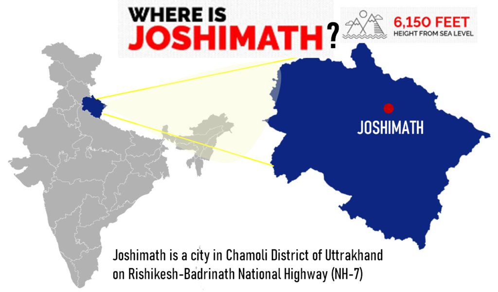
One of the nine blocks of the Chamoli district of Uttarakhand is Joshimath. It is situated in the Chamoli district’s northern region. The Joshimath block is located between latitudes 30° 17′ and 31° 07′ north and longitudes 79° 13′ and 80° 06′ east and there are 12,358 residences and 48,202 residents. In Joshimath block, there are 95 villages as per the 2011 Census.
Approach:
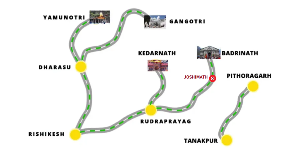
Joshimath is approachable from National capital-Delhi through road via NH 334 and NH 7, which is around 515 km and may take upto 12 hours.
Historical background:
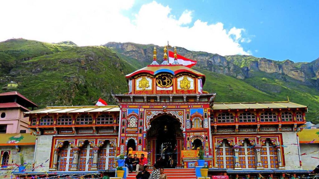
Joshimath, also known as Jyotirmath, is the winter residence of Lord Badri, whose idol is brought down from Badrinath Temple to Joshimath’s Vasudeva temple. This holy city is famous religious spot for Hindus because it serves as a significant national centre for pilgrimage. There are many other ancient temples and shrines including Narsingh temple, Shankaracharya Math and Bhavishya Badri. All these pilgrimage sites are visited by devotees as well as tourists every year.
Tourism:
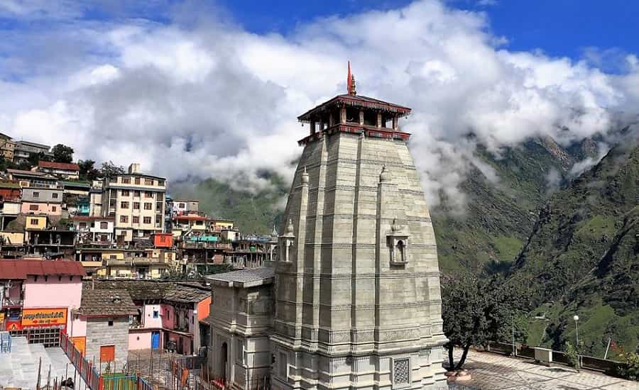
Joshimath’s economy is primarily based on tourism, and it is also popular halting place enroute Sri Badrinath. The majority of people rely on tourism as their main source of income. Additionally, people working in the tourism industry were able to make more money than those working in agriculture. As per statistical department, the total tourists visited Joshimath (Govindghat, Ghanghariya) is 167381 in year 2021.
Also it also sees large influx of tourist because it is the starting point of several treks and trails in the Himalaya and act as rest stop for Auli, valley of flowers and Hemkund Sahib.
Risk profile: Joshimath’s sinking- Warning for Himalayan towns?
- Environmental Vulnerability
- Social and Economic Vulnerability
1. Environmental Vulnerability
This area has always been the high risk zone which is prone to disasters like landslide, earthquake and cloud burst because Joshimath falls in the upper reaches of Ganga river basin which is vulnerable to climatic events.
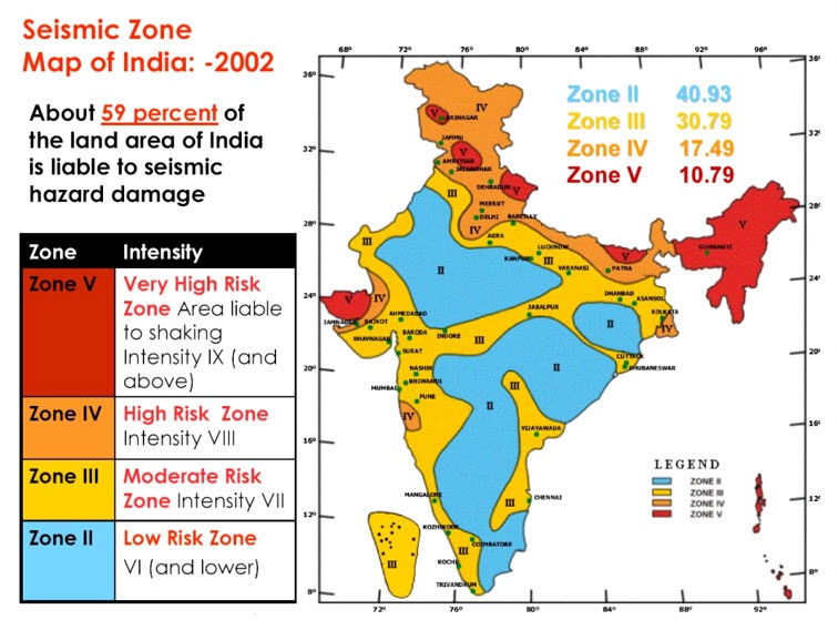
- Earthquake- According to Disaster Mitigation and Management Center Government of Uttarakhand, Joshimath comes in Zone 5, it is seismically the most active area which is most vulnerable to earthquakes. The built up area in Joshimath is dense and congested in certain parts with many buildings built without earthquake resistance. The built up area in Joshimath is dense and congested in certain parts with many buildings built without earthquake resistance.
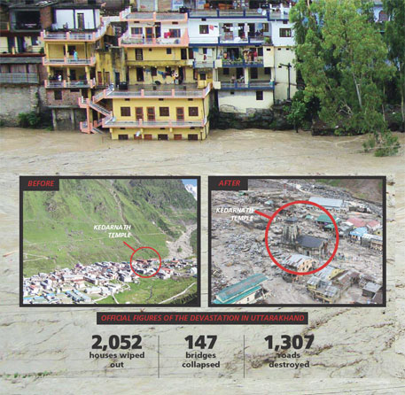
- Flood- Joshimath area is prone to floods, taking an example from 2013 Uttarakhand flood. The country’s worst natural calamity since the tsunami of 2004 was the 2013 flood. The amount of rain that fell that month was far more than what the state typically experiences. Major overflows were caused by debris blocking the rivers. The flood’s primary day was June 16, 2013.
- Landslides- Landslides frequently occur in Joshimath. Joshimath town was one of the most dangerous and landslide-prone spots in the area, according to a 2007 research that assessed the landslide hazard zones along the Joshimath-Badrinath road corridor. In fact, the Joshimath region had frequent landslides in the 1970s, which alarmed locals.
2. Social and Economic Vulnerability
Disaster or extreme climatic events will brings damage and the residents will be the most affected- directly or indirectly. In the hilly regions such as Joshimath the per capita income is quite less in comparison to the people residing in the metropolitan cities. The livelihood of the local people only depends upon agriculture and tourism and these two sectors will be mostly hampered in case of any disastrous event in the area. It may take several years for the local people to cope-up with the loss of infrastructure and property.
Why Joshimath is sinking- Natural or Man-made Disaster?

Well, there is not only one reason behind this unfortunate event but there are several. Joshimath is a case where the line between the natural and man-made disaster seems blur. This is the example of natural hazard exaggerated by series of man-made hazards and therefore turning it into the disastrous event. We can say that it is the combination of both natural as well as man-made disasters.
Natural Disaster:
The following natural disasters played a major role in the sinking of Joshimath:
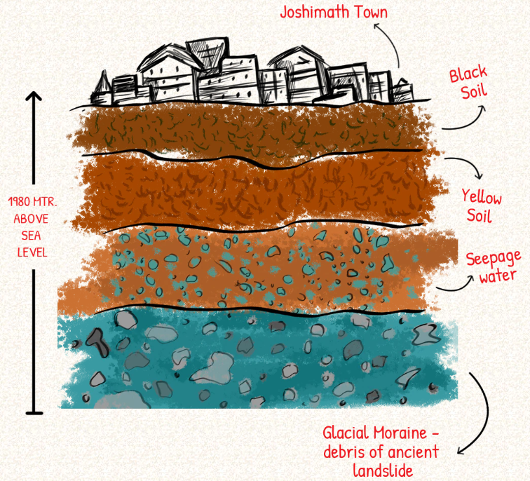
- Landslide- Joshimath was constructed over the remnants of a previous landslide, even small triggers might cause the slopes to become unstable.
As stated in the 1976 report of the M.C. Mishra committee, “Joshimath is a deposit of sand and stone, hence was not a good area for the building up of a township” heavy and unscientific construction was advised against in the town. Heavy traffic and blasting vibrations will also cause an imbalance in the natural forces.
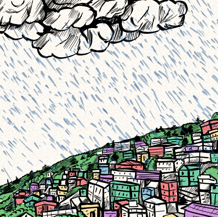
- Heavy Rainfall- A prolonged period of rain in the area over the past few years that increased the amount of water on the surface also contributed to the ground subsidence. The lack of solid rocks beneath, however, allowed the water to penetrate into the soil and loosen it from inside. Due to extensive building, the top layer of the earth has already been destroyed, leaving the area on the edge.
- Glacial & Cloud Burst- For the past ten years, rushing streams with a steep gradient from Vishnuprayag, a confluence of the Dhauliganga and Alaknanda rivers, have crossed the ridge that is home to Joshimath.
The confluence has withstood two significant glacial and cloud outbursts that left behind heavy sediments and significantly increased erosion in the area. Things got worse for Joshimath as a result of the eruptions, which carried debris equivalent to 10,000 houses in one day.
Man-made disaster:
Disaster and development have a very complex and multi-dimensional relationship. In the Uttarakhand region, the connection between calamity and growth is particularly obvious.The following are the man made disasters that are contributing factors for mishappening in Joshimath.
Role of National Thermal Power Corporation Limited (NTPC):
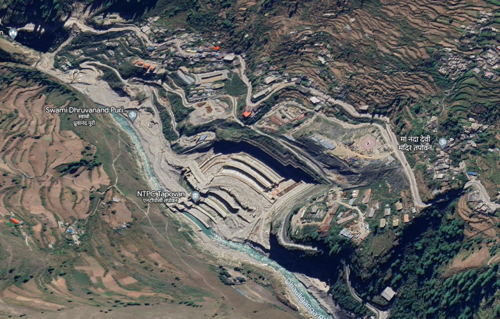
Locals have blamed the NTPC’s 520-MW Tapovan Vishnugad hydropower project, under construction in the area, for exacerbating the Joshimath land subsidence. Recently, NTPC has punctured a tunnel to connect Auli, near Joshimath for supply of water.
Char Dham project:
The 6-km Helang-Marwari bypass, being built by the Border Roads Organisation (BRO), is also under scrutiny for weakening slopes and further destabilising the local topography. The bypass is part of the 825-km Char Dham highway expansion project in Uttarakhand, which experts have already questioned for unscientific slope-cutting, which resulted in several landslides.
Inadequate drainage and wastewater disposal:
The 2022 USDMA report pointed to a lack of drainage and wastewater disposal systems as being part of the subsidence problem. About 85% of buildings in the town, including those owned by the army aren’t connected to a sewerage system and have soak pits instead.
Present situation : Joshimath’s sinking- Warning for Himalayan towns?
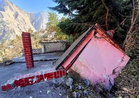
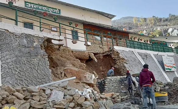
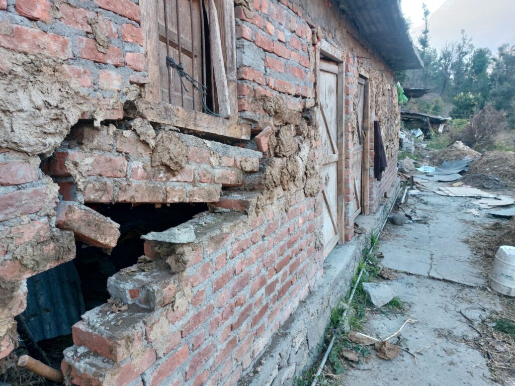
Present situation in Joshimath is quite poor, multiple cracks has been developed on houses. The terrain is currently sinking due to vertical subsidence, and soil and debris are slowly moving lower due to horizontal creep.
The first week of the New Year brought with it the first signs of cracks appearing on Joshimath inhabitants’ home walls and roads. Since the devastating floods that took more than 200 lives in February of last year. Yet it became impossible to ignore in the first few days of January this year. According to Chamoli District Disaster Management Authority, as many as 603 buildings in the sinking town have so far developed fractures. Huge cracks can be seen on the roads and even new water sources are emerging at some places.

Steps taken by Government:
There are following steps that government of Uttrakhand has taken recently for Joshimath’s sinking- Warning for Himalayan towns?
- Relief and rescue operations are being conducted. During this time, the central and state governments are working together. The entire crew has arrived at Joshimath to conduct an investigation, and findings will immediately be revealed via their research. Following that, appropriate action will be taken on the situation.
- In order to better protect residents from the potential dangers that land subsidence poses to their lives and property, Joshimath has been separated into three zones. The administration has divided the city into “Danger,” “Buffer,” and “Completely safe” zones as part of its efforts to relocate impacted residents to safer locations. A survey is being conducted by the administration to determine the danger and buffer zones
- The zone that is completely unsafe and needs to be evacuated right away has been referred to as a danger zone. A zone that is currently safe but could become threatened in the future is known as a buffer zone. The third zone is the absolute safe zone. Government has been collecting the details of number of affected families which includes both residential and commercial. Currently they are also in the process of collecting the data based on the occupation of these vulnerable people and based on the same, the shifting will be decided.
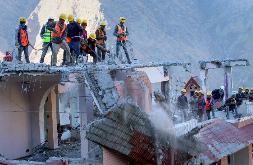
- Under the supervision of Nehru Institute of Mountaineering (NIM) and Public Works Department (PWD), the buildings that have sustained the worst damage will be torn down. Joshimath and the surrounding villages have already put a ban on construction, and the affected families are being relocated to temporary relief facilities.
Conclusion:
Blaming nature, climate change, or the local population for tragedies like the one in Joshimath is pointless. Religious tourism in ecologically sensitive areas with no regard for their carrying capacities and Environment Impact Assessment (EIA) can lead to the disaster like Joshimath. Government must have an Environment Management Plan (EMP) which is a guidance document to measure and achieve compliance with the environmental protection and mitigation requirements of the project. This is the high time that we should learn from Joshimath and take this case as an example for future vulnerable cities in the hilly regions of the country in Himachal Pradesh and Uttarakhand.
I hope you liked this blog Joshimath’s sinking- Warning for Himalayan towns? please let me know through your comments. Please share it with other people who are passionate about architecture and design. Contact us in case of any queries and also read my previous blogs related to architecture and travel. Thank you.


